
Sotavento is not a single compact beach but a huge coastal landscape. Around nine kilometres of sand are divided into five named sections—La Barca, Risco del Paso, Mirador, Malnombre and Los Canarios—and the look of the place changes dramatically with the tide. At certain stages, shallow lagoons form behind sand bars; at others, the beach feels almost impossibly wide.
Wind is part of Sotavento’s identity, which is why the area is internationally associated with windsurfing and kitesurfing. For nearby accommodation, compare Costa Calma and Morro Jable and Jandía.
At a glance
| Island | Fuerteventura |
|---|---|
| Area | South-east Jandía, between Costa Calma and Morro Jable |
| Length | About 9 km across five beach sections |
| Character | Wide tidal sands, lagoons and frequent wind |
| Typical visit | Half day to full day |
| Best for | Long walks, wind sports, photography and spacious beach time |
Why Sotavento Beach Fuerteventura is worth visiting
The scale is the main attraction. Even in busy periods, the beach can feel open because the usable sand expands enormously at lower tide. The pale sand and clear water create the classic Fuerteventura colour palette, while the lagoon adds a completely different texture to the shore.
Sotavento is also a place where beachgoers and water-sports enthusiasts coexist. Some sections are better suited to lessons and equipment hire; others feel much quieter. Choosing the correct access point matters more than trying to “see” all nine kilometres.
What to see and how to experience it
If your goal is the lagoon, check tide information and local conditions before travelling. The lagoon is a tidal phenomenon, not a permanent swimming pool that looks identical every day. Wind can also change how pleasant a beach picnic or family stop feels.
For a simple first visit, Risco del Paso and La Barca are logical sections because they are well known and easy to combine with Costa Calma. Walk along the shoreline, but remember that a long walk with the wind behind you can become surprisingly demanding on the return.
How to get there and plan the route
The beach is reached from different turn-offs along the main south-island road. Do not rely on the single map pin labelled “Sotavento”; choose the beach section first, then navigate to that access. Parking and services differ by section.
If you are making a road trip, Sotavento fits naturally between Costa Calma and Morro Jable. Our 5-day Fuerteventura itinerary shows how to combine the south with Betancuria and the north without wasting time on repeated drives.
Tickets, opening details and what to check
Sotavento is a public beach area with no general admission ticket. The official Fuerteventura tourism page describes the full stretch as about nine kilometres and confirms the five principal beach sections, wind-sports facilities and the tidal lagoon.
Water-sports lessons, rentals and organised activities are separate commercial services. If you book one, confirm the exact meeting point because “Sotavento” can refer to a long stretch of coast.
A realistic visit: how much time to allow
Most travellers do better when they give Sotavento Beach Fuerteventura a clear role in the day rather than treating it as one more pin on a map. Use the typical-visit estimate above as a minimum planning block, then add driving, parking, food and photo time. Canary Islands roads often look short on a map but can be slow when they cross volcanic or mountainous terrain.
If you have a fixed reservation elsewhere, work backwards from that time and leave a generous buffer. A relaxed plan is especially valuable when wind, cloud, tides or road conditions affect the experience. The islands reward flexibility: if one stop is not working, moving to a different altitude or coast can completely change the day.
Best nearby places to combine with the visit
Costa Calma
The most convenient northern base for Sotavento.
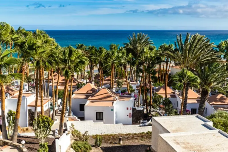
Morro Jable
A larger southern resort and port with a long serviced beach.
Cofete
A spectacular but much rougher west-coast excursion.
La Lajita
A small coastal settlement between Costa Calma and Gran Tarajal.

Pájara
An inland municipality centre worth adding to a mountain-road day.
Visiting with children
Families should choose the beach section and weather carefully. The lagoon can create shallow water, but tides and wind are dynamic and adult supervision remains essential. On very windy days, blowing sand can make the beach uncomfortable for small children even when the temperature is pleasant.
Best time of day and weather considerations
Use the tide, not just the clock, to plan the classic lagoon view. Morning often gives easier parking and cooler walking, while afternoon light can be excellent for photographs. Wind tends to be an important factor year-round, with particularly strong conditions possible in summer.
What to bring
- Water: even short stops become dehydrating in wind and sun.
- Sun protection: sunscreen, sunglasses and a secure hat are useful year-round.
- A light layer: viewpoints and northern areas can feel much cooler than resort beaches.
- Suitable footwear: choose shoes for the actual surface, not just the temperature.
- Offline directions: save the route and key confirmations before leaving reliable mobile coverage.
Responsible visiting and safety
The Canary Islands are visually robust but ecologically fragile. Stay on authorised paths, use established access points, take all rubbish away and never build stone stacks or remove volcanic material, shells or plants. In protected areas, a barrier or closure is part of the conservation system rather than an inconvenience to work around.
For beaches and natural pools, make the decision to enter the water from the conditions in front of you, not from photographs taken on another day. Respect lifeguard flags, warning signs and local advice. For mountain and forest routes, check official trail status after rain, wind, fire-risk periods or maintenance closures.
How this stop fits into a first trip
If this is your first visit to the archipelago, use our Canary Islands travel guide to decide how much of your holiday should be beaches, towns, nature and driving. A good itinerary normally has one major objective per half-day, with smaller nearby stops added only when they are genuinely on the route.
That approach is especially useful on the smaller islands, where a day can look empty on paper but feel full once scenic roads, viewpoints and local meals are included. It also gives you space to return to a favourite place rather than turning the holiday into a race.
Frequently asked questions
Is the Sotavento lagoon always there?
No. Its size and appearance depend on tides and conditions, so check tide information before making it the focus of your visit.
Which beach is Sotavento?
Sotavento is a long coastal system made up of five principal beaches, including La Barca and Risco del Paso.
Is Sotavento good for swimming?
It can be in suitable conditions, but wind, tide and the specific section matter. Follow local warnings and choose calmer water if you are not a confident swimmer.

Is it good for beginners in windsurfing?
The area is famous for wind sports and some lagoon conditions are used for beginner lessons. Book with a reputable school and follow instructor guidance.
Final advice
Sotavento Beach Fuerteventura is most rewarding when you plan for the real conditions of the place rather than the ideal version seen in photographs. Check the official information before you leave, give yourself enough time, and keep one flexible alternative nearby. That small amount of planning usually makes the difference between a rushed stop and one of the days you remember from the trip.
Planning mistakes to avoid
The most common mistake at Sotavento Beach Fuerteventura is underestimating the difference between arrival time and experience time. Parking, walking from the car, checking conditions and orienting yourself can easily add 20–40 minutes before the visit really begins. Build that margin into the day instead of cutting the final stop short.
A second mistake is following an old itinerary without checking live access information. The Canary Islands increasingly manage busy natural sites with permits, timed tickets, parking rules or temporary closures. Save the official page before travel and check it again when the visit depends on a specific trail, road or attraction.
A third mistake is planning every meal and stop at the exact same latitude or altitude. Weather on the islands is highly local. If cloud covers a viewpoint, the coast may be sunny; if strong wind makes a beach unpleasant, a village or museum inland may be comfortable. Keep your route modular so you can switch the order without losing the day.
Finally, avoid judging value only by how many attractions you fit in. One long beach walk, a slow museum visit or an hour watching changing cloud over a volcanic valley can be more memorable than five rushed photo stops. The best Canary Islands itineraries are selective, not exhaustive.
A simple half-day plan
For a low-stress half day at Sotavento Beach Fuerteventura, start by arriving before the busiest middle part of the day and spend the first 15 minutes orienting yourself rather than immediately following the crowd. Identify the main viewpoint, trail, beach section or indoor route, then decide what deserves most of your time. This prevents you from spending the visit moving constantly without actually experiencing the place.
After the main experience, leave at least 30–45 minutes for the less obvious part of the site: a secondary viewpoint, a slower walk, a café, a short stretch of coast or a nearby village. That buffer also absorbs parking delays and weather changes. If conditions are poor, reverse the plan and use the nearby stop first, then return when visibility, tide or wind improves.
For lunch, choose somewhere naturally on the onward route rather than driving back to a resort simply because it has more restaurants. One of the pleasures of exploring the islands is connecting landscapes with local settlements. A simple meal in a nearby village often makes the day feel more coherent and reduces unnecessary driving.
If you are travelling in peak holiday periods, keep the final part of the half day flexible. Popular parking areas and ticketed attractions can take longer than expected, and a rigid schedule creates pressure to speed through the very place you came to see. One major stop plus one nearby extra is usually the right rhythm.