
Volcanic landscapes are the common thread linking the Canary Islands, but walking through them feels completely different from island to island. Lanzarote offers young-looking lava fields and accessible craters, La Palma has long high-level volcanic ridges, Tenerife reaches true high-altitude terrain, and Fuerteventura’s older cones rise from broad eroded plains.
This guide focuses on hiking rather than geology alone. For the broader activity picture see our Canary Islands hiking guide, and for protected attractions use the dedicated guides to Timanfaya, Cumbre Vieja and Calderón Hondo.
Best planning rule: choose the route after checking the local forecast and current trail status, not weeks in advance simply because it is famous.
The best routes at a glance
- Ruta de los Volcanes, La Palma — For a full-day volcanic journey, few routes in the archipelago compare with La Palma’s Ruta de los Volcanes.
- Volcán del Cuervo, Lanzarote — At the opposite end of the effort scale, Volcán del Cuervo gives a close volcanic experience on a short, approachable route.
- Caldera Blanca, Lanzarote — Caldera Blanca adds scale and exposure.
- San Antonio and Teneguía, La Palma — The southern volcanoes around Fuencaliente combine accessible visitor infrastructure with stark volcanic scenery.
- Calderón Hondo, Fuerteventura — Calderón Hondo rises from the north of Fuerteventura and provides a manageable crater walk with broad views over the volcanic chain.
- Teide highlands, Tenerife — Tenerife’s volcanic hiking is defined by altitude.
- Los Volcanes Natural Park, Lanzarote — Beyond Timanfaya’s controlled visitor experience, Best hikes and walks to consider
Ruta de los Volcanes, La Palma
For a full-day volcanic journey, few routes in the archipelago compare with La Palma’s Ruta de los Volcanes. The official tourism site lists the core route at around 17.5 kilometres with high difficulty and major elevation change. Pine forest gives way to cones, ash and open ridge views. Transport planning is essential because the classic route is linear.
Volcán del Cuervo, Lanzarote
At the opposite end of the effort scale, Volcán del Cuervo gives a close volcanic experience on a short, approachable route. The official tourism portal describes it as low difficulty and suitable for families. The path crosses lava country and reaches the crater environment without requiring a high mountain day.
Caldera Blanca, Lanzarote
Caldera Blanca adds scale and exposure. Its pale cone stands above dark lava fields, creating one of the island’s strongest geological contrasts. The longer route and wind exposure make it more demanding than Cuervo. It is a good progression for walkers who want a half-day rather than a short circuit.
San Antonio and Teneguía, La Palma
The southern volcanoes around Fuencaliente combine accessible visitor infrastructure with stark volcanic scenery. Walking here helps connect historic eruptions with the island’s vineyards, salt pans and coast. The route is exposed to sun and wind, so the cooler morning hours are usually more comfortable.
Calderón Hondo, Fuerteventura
Calderón Hondo rises from the north of Fuerteventura and provides a manageable crater walk with broad views over the volcanic chain. It is a strong choice for travellers based in Corralejo, Lajares or El Cotillo. Wind can be significant at the rim, so stay on the established path and keep back from exposed edges.
Teide highlands, Tenerife
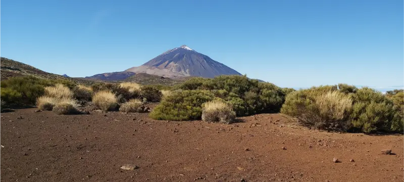
Tenerife’s volcanic hiking is defined by altitude. Routes across the national-park highlands can pass lava formations, pumice, old flows and enormous views without necessarily attempting the summit. Summit and certain high routes may involve permits or temporary restrictions, so consult official Teide National Park information before finalising a route.
Los Volcanes Natural Park, Lanzarote
Beyond Timanfaya’s controlled visitor experience, Los Volcanes Natural Park contains signed walking opportunities through a broader eruption landscape. Caldera Blanca and Volcán del Cuervo are the best-known examples. The most important rule is simple: volcanic crust and pioneer vegetation are fragile, so do not create shortcuts across lava fields.
Cumbre Vieja, La Palma
Cumbre Vieja is not one single trail but a volcanic mountain system containing some of La Palma’s most important routes. The landscape includes pine forest, cones and areas shaped by recent eruptions. Use our Cumbre Vieja guide and current island trail notices because access can evolve after maintenance, fire or volcanic impacts.
El Hierro volcanic landscapes
El Hierro’s volcanic walks feel quieter and less monumental than Teide, yet the island’s young geology is everywhere. Routes around La Llanía, the central ridge and the south reveal craters, lava textures and abrupt changes between forest and bare ground. The advantage is variety within short driving distances.
Bandama, Gran Canaria
Bandama gives Gran Canaria an accessible crater experience close to Las Palmas. The combination of viewpoint and caldera walking works well for travellers who want geology without a remote mountain day. See our Bandama Caldera guide before choosing the exact route and check access conditions locally.
How to choose the right hike
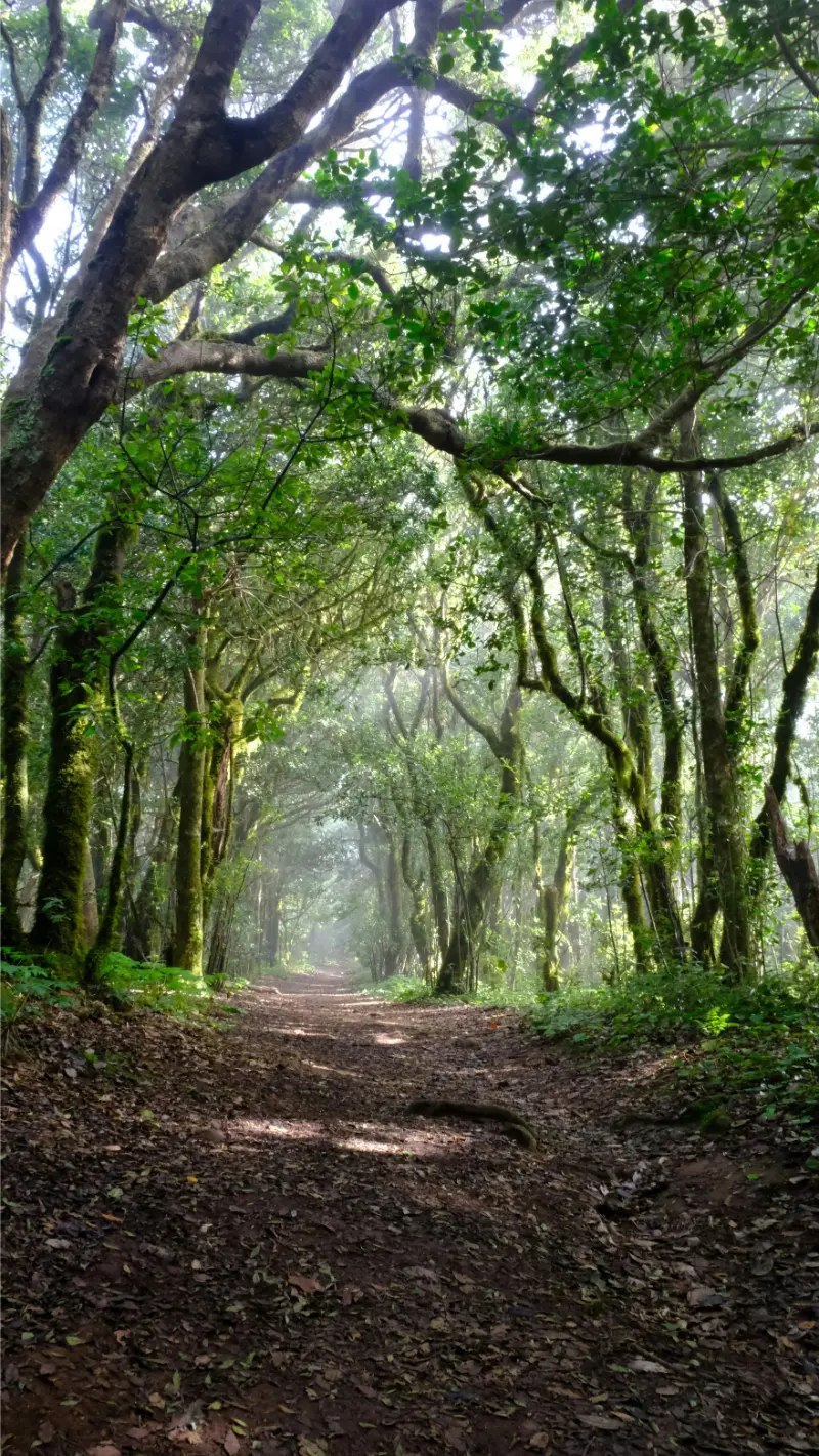
Start with the experience you want rather than the number of kilometres. Volcanic routes are usually exposed and visually dramatic; laurel-forest walks can be cooler and slippery; coastal paths offer flexible distances but may be windy; summit routes add altitude, temperature changes and greater commitment. Two routes with the same distance can therefore feel completely different.
Look at total ascent, surface, exposure and whether the route is circular or linear. Linear trails create a transport problem that should be solved before departure. If anyone in the group is uncomfortable with heights, steep loose descents or strong sun, choose the route for that person rather than for the strongest walker.
Weather and the best time to walk
Volcanic terrain amplifies sun, wind and exposure. Black surfaces can become very hot, while high volcanic ridges may be cold even in summer. Loose lapilli and sharp lava punish flimsy footwear. Carry water, protect skin and eyes, and never assume a short route is harmless simply because the sky is clear.
Check the forecast again on the morning of the hike. Strong wind, intense heat, recent rain, wildfire restrictions, rockfall or maintenance can change a sensible plan. The Canary Islands are excellent for flexible itineraries because another coast or altitude often has very different conditions. Keep one shorter alternative saved offline.
Getting to the trailhead
Many volcanic trailheads are easiest by car, but parking limits and protected-area rules can make organized transport smarter in specific locations. Read our driving guide and the relevant national-park page before deciding. Never park on fragile ground or block emergency access.
Download the route or map before leaving reliable coverage, confirm where legal parking is available and never block tracks used by residents, farmers or emergency vehicles. If using a taxi for a linear route, agree the pickup point carefully; rural trailheads can be difficult to describe once mobile coverage becomes weak.
What to pack for hiking in the Canary Islands
- Water: carry enough for the full route and an unexpected delay; do not rely on springs.
- Sun protection: high-SPF sunscreen, sunglasses and a hat are useful even in winter.
- Footwear with grip: volcanic gravel, cobbles and wet forest surfaces punish smooth soles.
- Windproof or light waterproof layer: especially for ridges, cloud forest and high ground.
- Offline map and charged phone: mobile coverage can be intermittent on remote routes.
- Food and a small emergency margin: many trailheads have no shops or cafés.
- Simple first-aid kit: blisters and minor cuts are much easier to manage early.
Safety and responsible hiking
Stay on signed or clearly established trails, obey closures and barriers, and never create cairns or shortcuts across lava, dunes or fragile vegetation. Do not remove stones, plants or other natural material. These rules are not cosmetic: volcanic soils and pioneer plants can take years to recover from repeated trampling.
Tell someone where you are going on remote routes, especially if walking alone. Turn around when conditions deteriorate rather than treating the planned endpoint as mandatory. In an emergency in Spain, call 112. A conservative decision early in the day is almost always easier than solving a problem after dark.
Where to stay for a hiking holiday
The best base is not automatically the closest hotel to one famous trail. Choose a place that gives access to several landscapes, food after a long day and a realistic road or bus connection. If you plan four or five serious hikes, splitting the stay between two bases can reduce driving and give you better weather options.
FAQ
Are volcano hikes Canary Islands suitable for beginners?
Some are, but difficulty varies widely. Choose a route with manageable distance and elevation, then factor in heat, wind, surface and exposure. A short volcanic or forest walk is usually a better first choice than a famous summit simply because it appears on a must-do list.
Do I need hiking boots?
For easy dry paths, supportive walking shoes may be enough, but grippy hiking footwear is the safer choice on loose lava, damp forest paths and steep descents. Sandals and smooth-soled trainers are poor choices for most mountain routes.
Can I hike year-round?
Yes, but not every route is ideal every day. Summer heat can make exposed lava routes uncomfortable, while winter weather can be cold and windy at altitude. Use the forecast for the exact trail area and keep a lower or shorter backup option.
Do I need a car?
Not always. Some walks start near towns, beaches or bus stops, while remote trailheads are much easier by car. Linear hikes may actually work better with a taxi or public transport so you do not have to return to a parked vehicle.
Should I book anything in advance?
Some protected areas, summit routes, visitor attractions or regulated paths may require permits, timed access or reservations. Rules can change, so check the official authority shortly before the hike rather than relying on an old screenshot or third-party blog.
Final planning advice
Choose fewer walks and enjoy them properly. A good hiking holiday leaves time for a slow lunch, a swim, a village stop or simply an earlier finish when the weather changes. The Canary Islands reward that flexibility because landscape changes quickly with altitude and orientation.
For current trail information, protected-area notices and route inspiration, check the official tourism hiking information before setting out.